Last week I touched on the wonders of Lerwick for my paid subscribers. It’s such a marvellous place, though, that everyone should know about it.
Lerwick has a wow around every corner. The walk from my hotel to the local Tesco was approximately seventeen billion, nine hundred and twenty-eight million, six hundred and forty-seven thousand, nine hundred and twenty-three times better than the same walk from the Hilton Garden Inn at Hatton Cross to the Tesco on Faggs Road, despite the fact that they are almost precisely the same distance.
I left my bed and breakfast on Harbour Street and walked past Fort Charlotte. The fort, as it is today, was built in 1781 and named after George III’s wife; there was a garrison stationed here during the Napoleonic wars.
There were earlier forts here when Britain was at war with the Dutch rather than the French. Its cannons still face out to sea but the road and harbour in front of it is largely on reclaimed land which has been created in the centuries since. Now you can walk along a street between its walls and the water, I did just that into the town of Lerwick.
Stone two and three-storey buildings with splendid shops on the ground floor. Harry’s Department Store is the first shop I came across; it offers gifts, souvenirs, cards, houseware, kitchenware, linen, toys, cycles and everything you need for the nursery. It is possible that you could do all of your Christmas shopping in Harry’s; I’m not sure how popular you’d be, but it is possible.
There’s the odd smattering of the usual high street chainstores but there are so many more individual, local shops and cafes. The narrow main street was decked with primary-coloured bunting and for all I know, it looks this way every day, just celebrating the fact that it is Lerwick.
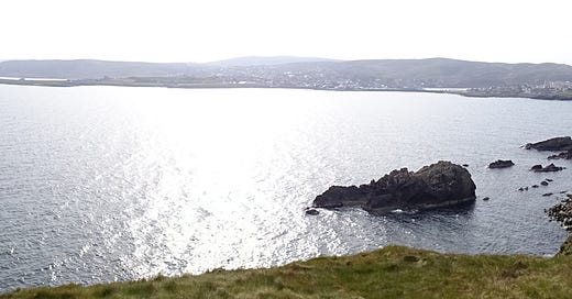
Every now and then, there are short roads to my left that lead to the harbour and the deep blue waters of Bressay Sound and the low green hills of the island of Bressay. Then, just after the Magpie’s Nest antique shop, there’s a tiny, walled beach, just forty yards of sand and bright, clear water with stone buildings on two sides and a high wall by the street on the third. The shops start to become houses and then you’re out in the open with rugged rocks and clear water to your left. I know that I’ve said clear water twice now but it really is amazingly clear, you can see right to the seabed almost all the way over to Bressay.
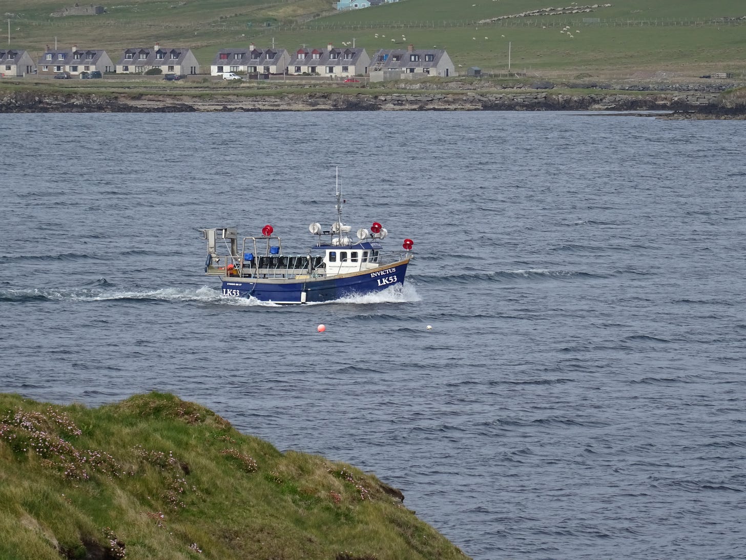
It’s less than half a mile to Bressay and as I join the coast path at Twagoes Point the Lerwick based fishing boat, Invictus, keeps pace with me out in the sound. It has a navy blue hull and little white wheelhouse, behind which I can make out ten black crates tied to the boat by light blue rope. I suppose that they must be lobster pots sitting on a silver gantry taking up the whole rear of the boat. Over on Bressay I can see low houses and farm buildings and the odd wind turbine. I imagine in winter here, one small turbine could produce enough energy to power the whole island the way the wind must whip through the narrow straits. The coast path follows the cliffs of South Ness and The Knab. Over on the Ward of Bressay, the highest point on the island, is a tall mast which transmits all of the radio and television signals for the Shetland Islands.
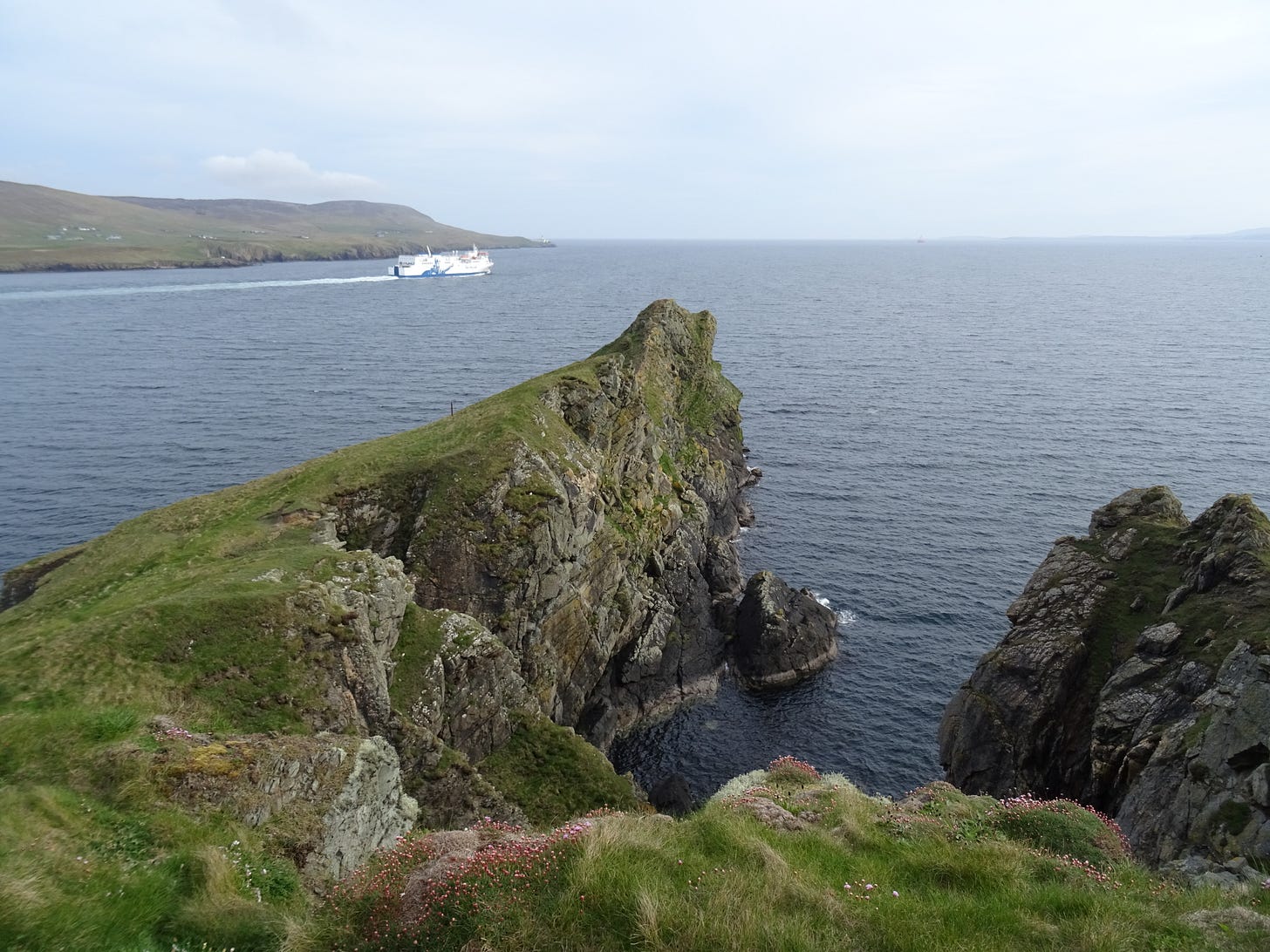
Gulls nest and swoop and mew and caw as I walk along. The big white North Link ferry Hrossey with its little orange lifeboats heads past me out to sea past the lighthouse at Kirkabister Ness. On the side of it a huge painted Viking with horned helmet and flowing beard points out towards the open sea. This ferry links the Shetlands and Orkneys with mainland Scotland. The name of this one, Hrossey, is the old Norse name for Orkney and means “the horse island”.
It’s the more remote Shetlands that we link with ponies these days. The Celtic ponies were probably first brought here in the second millennium BC and then crossed with ponies brought by the Norse settlers two thousand years later, before being exported for use in the pits during the Industrial Revolution.
I walked past the rocks known as the Horse of the Knab and headed back towards town along the edge of The Knab Golf Course and around the curving cliffs that form a natural bay around the bit of water known as Brei Wick.
Then I passed the world’s most spectacularly situated Tescos and continued just a couple of hundred yards to the Broch of Clickimin, a breathtaking Iron Age broch on the banks of a small loch. It would originally have stood on an island in the loch linked by a causeway. There’s the central, circular structure which still stands sixteen feet tall and an outer protective fort which is like a rounded-off triangle when seen from above.
When the broch was at its height, both literally and figuratively, in the centuries either side of the birth of Christ, it would have stood around fifteen metres high and had three or four floors and may have had a turf covered domed roof.
The single entrance today is still one that you have to crouch or crawl through. This was the first building in Britain to be protected by the Ancient Monuments Act of 1886 and rightly so. It is an incredible place to visit and I had it all to myself on this Monday evening. Well, me and an oystercatcher who had found himself a very juicy worm for his tea. That reminded me of why I’d come out in the first instance and I headed for Tescos.
The next morning it was back to Sumburgh. Incidentally, Sumburgh owes its name to brochs or, at least, they come from the same root. Borg is Norse for a stronghold.
The grass strip that originally formed Sumburgh Airport was laid out in 1936 and the first flight arrived from Aberdeen on 3rd June. It was a De Havilland Dragon Rapide G-ACPN piloted by Captain Ted Fresson of Highland Airways.
Ernest Edmund "Ted" Fresson, OBE was born in 1891 and served in the Royal Flying Corps during the First World War. There is a memorial to him here, with a bronze model of a Dragon Rapide flying low over the waves.
There are memorials at Wick and Kirkwall, too, and a statue of him, resplendent in plus-fours, which stood for many years outside Inverness Airport. Although, for some reason, this has been moved inside and he now stands looking rather put-out in the middle of the baggage carousel. He told his truly incredible life-story in his wonderful autobiography Air Road to the Isles. The Dragon Rapide he flew in on that June day in 1936 was bought in the August by Juan de la Cierva and Louis Bolin.
Juan de la Cierva was a rather chunky Spanish chap who invented the first ever autogyro in 1923 and is, therefore, probably responsible for the birth of the helicopter in later years. Proper aeroplanes got their own back, though, and he was killed whilst flying as a passenger on a KLM Douglas DC-2 on 9th December 1936, incidentally, the same date that I died in the forest while walking my dogs.
I got better, though, whereas Juan de la Cierva was on board an aeroplane which took off from Croydon Airport in fog, crashed into a house and then exploded. Not many people get better from that. Just a month before buying G-ACPN, Louis Bolin had been instrumental in the events which led up to the Spanish Civil War. He organised the flight of a different Dragon Rapide from Croydon to the Canary Islands, in order to transport General Franco from there to Spanish Morocco to begin preparing troops. Bolin and our Dragon Rapide G-ACPN both served on the side of the Nationalists in the war.
There are those who have called the Spanish Civil War the first battle of World War Two and, during that later conflict, Ted Fresson acted as an advisor to the Air Ministry. He was responsible for what was one of the earliest, if not the very first, paved runway in the British Isles when he advised the construction of one at HMS Sparrowhawk, a Royal Naval Air Station, one mile to the northwest of Kirkwall. Following the success of the experiment in Orkney, hard runways were laid at what had become RAF Sumburgh. This is now Sumburgh Airport and, sadly, the place from where I had to now leave the island.


